
Firewise landscaping matters in Jackson Hole.
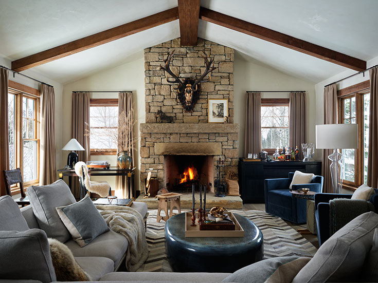
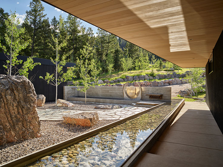
A misconception about firewise landscaping is that it means hardscaping everything, but landscape architect Hans Flinch says that is not the case. “You can do firewise landscaping and make it beautiful and native, and hardscaping can take many forms, including pathways and water features.”
Story
The Homestead Team
Photos
Courtesy Cairn Landscape Architects/Krafty Photos
Wildfire is no longer a distant and infrequent threat. It is now part of the calculus of owning a home and living in Jackson Hole. According to wildfirerisk.org, a website with interactive maps, charts, and resources created in 2018 by the USDA Forest Service under the direction of Congress, the risk of wildfire in Teton County is higher than in 88 percent of counties in the U.S. This is slightly lower than the risk of wildfire in Park City, Utah, but higher than in Steamboat Springs, Colorado.
Firewise landscaping has emerged as a crucial defense, allowing residents to maintain beauty and biodiversity while reducing the risk that one stray ember could turn a dream house into an insurance claim.
The Changing Fire Reality of Jackson Hole
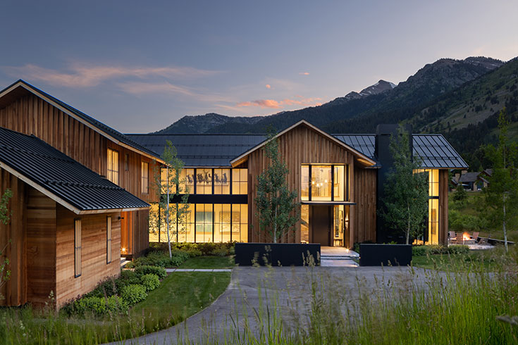
Jackson Hole’s natural landscape—a high desert with dense, conifer-dominated forests and seasonal droughts—was shaped by fire long before development arrived. Historically, low-intensity burns cleared underbrush, recycled nutrients, and maintained healthy ecosystems. But a century of aggressive suppression policies has left many forested areas packed with dense fuel, waiting for a spark.
Layered on top of that are hotter, longer summers; an increase in the number of hot, dry, windy days; the spread of invasive species that dry out earlier than native species; and more frequent drought conditions. The Greater Yellowstone region’s fire season now lasts roughly six weeks longer than it did in the 1970s. The frequency of high-intensity crown fires—those that leap from treetop to treetop—has roughly doubled over the same period.
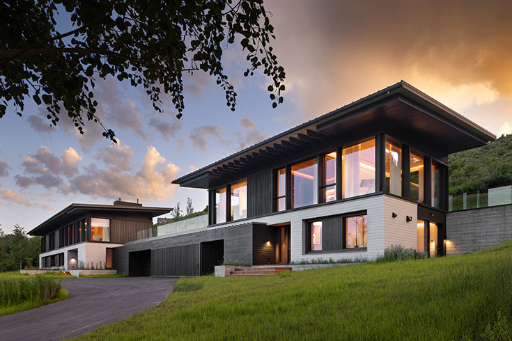
The earlier in the design process you start to think about hardening your home against fire, the better. Having it on your radar from conception allows you to incorporate materials, like concrete, that will stand up to fire.
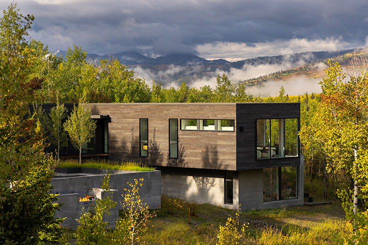
For a community like Jackson Hole, framed by the Bridger-Teton National Forest and Grand Teton National Park, that means fire hazard literally meets the backyard fence line. The wildland-urban interface (WUI)—the zone where human development meets flammable wildland vegetation—expands every time a new home is built.
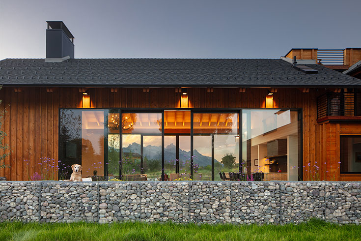
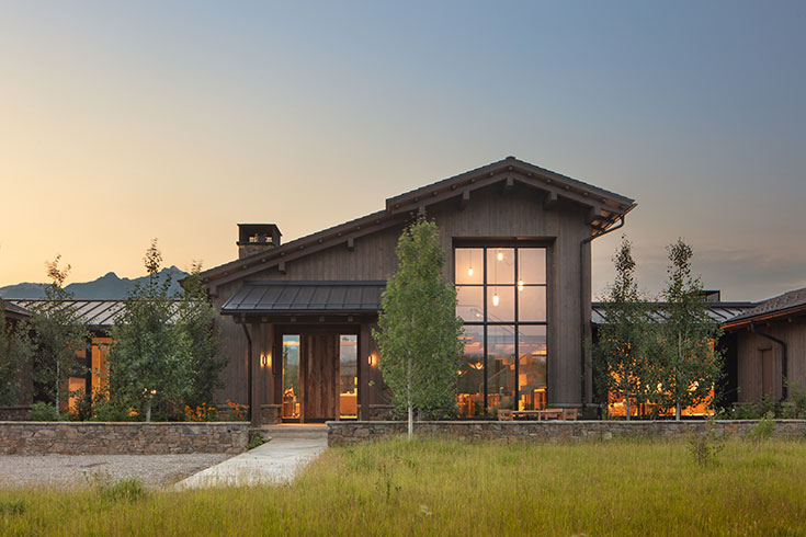
As of 2025, all private lands in Teton County are considered to be in the WUI zone and must adhere to wildfire-specific construction requirements. These requirements differ based on where a home is: a house tucked into the forest off Fall Creek Road will have different guidelines than one in East Jackson, but all new homes in Jackson Hole must now meet a basic level of ignition-resistant construction. An example is that wood shakes and shingles are no longer allowed for any new construction anywhere in the county.
“All homes in Jackson Hole have some level of risk from wildfire. Whether in downtown Jackson, Moran, or Hoback Junction, every landowner has some exposure to wildfire,” says Robb Sgroi, land resources specialist at Teton Conservation District and a certified wildfire-mitigation specialist and arborist.
Don’t Trust Our Historical Luck
While Sgroi is not aware of any occupied structure in Teton County being lost to a wildfire, he says, “If we expect past performance to inform future outcomes and don’t take proactive action, that is an unsafe path to follow.” The July 2001 Green Knoll Fire forced the evacuation of hundreds of homes south of Wilson—in neighborhoods including Crescent H and Indian Paintbrush—and came within feet of some homes. The 2012 Horsethief Canyon Fire came within three miles of East Jackson and threatened several homes in the Little Horsethief Canyon area, but ultimately firefighters, with the help of a shift in weather, prevented any structures from being lost.
“Our firefighters have been incredibly effective in suppressing wildfire, and weather turned in our favor in both of these cases,” Sgroi says. “But we might not always have the firefighting resources we did for these two fires, and the weather could go in the opposite direction. It’s not difficult to imagine a future wildfire having a very different outcome, so the more homeowners can do to harden their homes against fires, the better.”
“When it comes to reducing wildfire risk, we really need to look at it at a community level and not purely what we want individually. If one person’s house floods, that doesn’t impact the neighboring house. But if one house catches fire, the neighboring house might, too. We should recognize that our responsibility goes beyond our own property boundaries. If we really want to see Teton County fire-adapted, we need to come together and work as neighbors. We elected to live in a fire-adapted ecosystem, so we need to be responsible to it.”
— Bobbi Clauson, Wildfire Mitigation Coordinator, Jackson Hole Fire/EMS
What “Firewise” Really Means
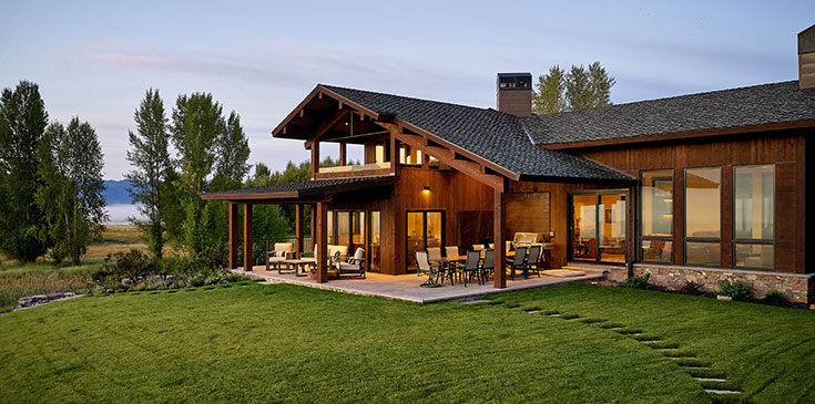
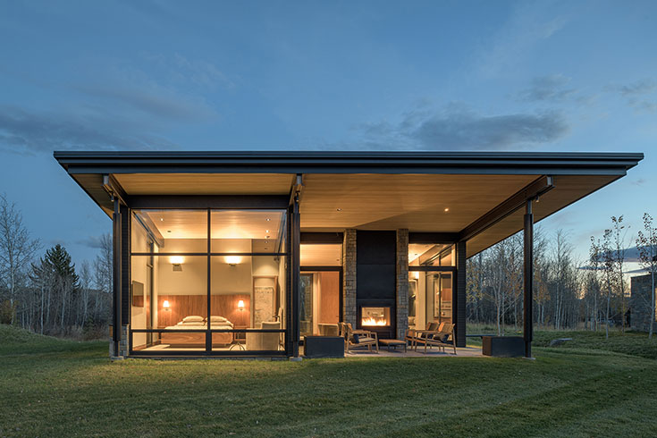
Firewise is more than a single practice; it’s a holistic approach to making structures and their surrounding landscapes more resistant to fire ignition and spreading. At its core, being firewise is about defensible space—the buffer zones around your home where fire intensity can be reduced and firefighters can safely operate. These zones are typically divided into concentric rings, starting with the house itself and extending roughly a hundred feet outward, or as far as the property allows. (See sidebar for details.)
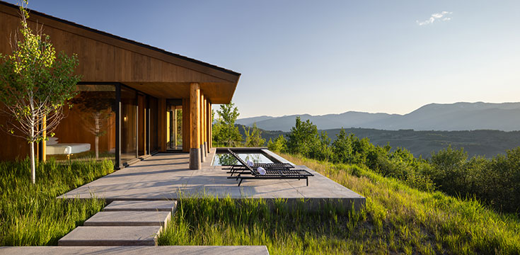
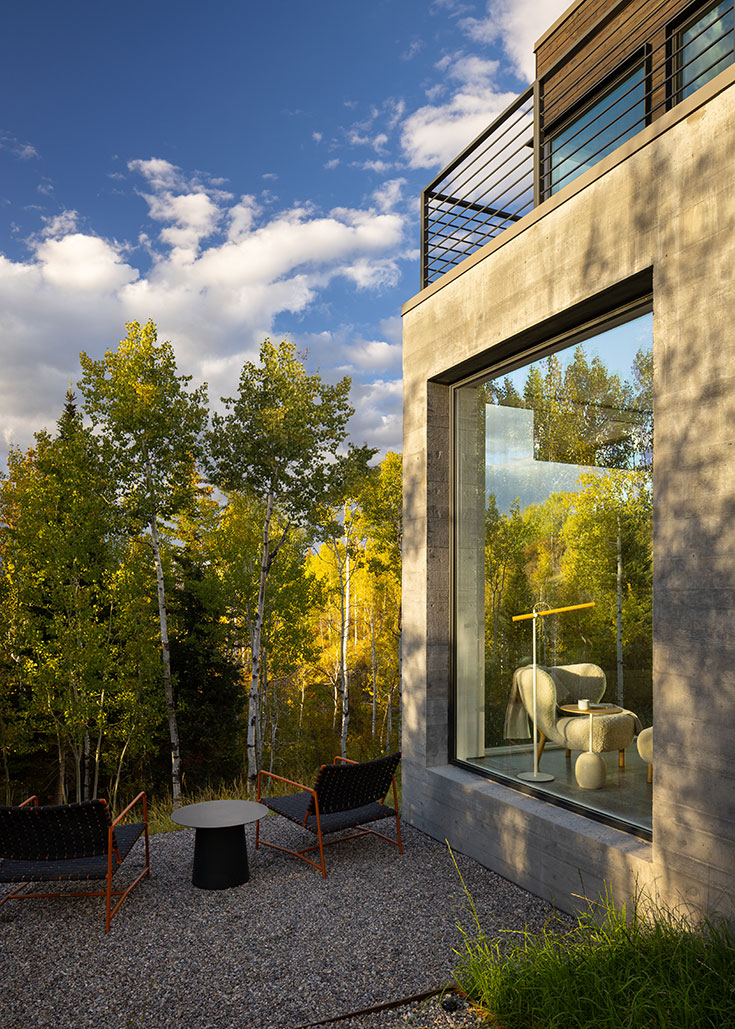
Firewise landscaping isn’t about stripping away every tree and blade of grass, though. “It’s a common misconception that ‘firewise’ means you’re hardscaping everything,” says Hans Flinch, a landscape architect and founder of Cairn Landscape Architects. “You can do firewise landscaping and make it beautiful.” Bobbi Clauson, Jackson Hole Fire/EMS wildfire-mitigation coordinator says, “Firewise landscaping does not mean a barren landscape. It just means being selective.”
Greg Jackson, general manager and managing partner at Boreal Property Management, which has an arborist on staff, says clients are almost always nervous about pruning trees to make their property more defensible … but end up surprised by and pleased with the results. “So often we hear, ‘I didn’t expect I would like it so much. It opens up the space.’ We know how to be strategic with the trees that we remove and the ones we work to keep as focal pieces.”
Homeowners whose 1.38-acre property south of Wilson abuts the Bridger-Teton National Forest and was itself dense with trees had 57 trees removed before they moved in. “The forest is so beautiful—it is the reason everyone who lives on our street lives there,” they say. “It felt wrong to manage and tame it, but it looks even better now. When we started taking out trees around the perimeter, the views of the forest became even better. Now we can see the deer and birds.”
The Three Defensible Zones
Zone 1: The Home Ignition Zone (0–5 feet)
This narrow band is often the difference between survival and loss. Embers—tiny, wind-borne fragments of burning material—are what cause most homes to ignite during wildfires. They can land unnoticed in mulch, vents, or patio furniture. “The latest science says that the best thing you can do is give a five-foot nonflammable buffer around your house,” landscape architect Hans Flinch says. “What exactly that buffer is—we can be creative. We’ve done pathways, walkways, and irrigated plant material.”
Zone 2: The Intermediate Zone (5–30 feet)
This zone acts as a speed bump, slowing a wildfire’s advance. Trees and shrubs should be well spaced and pruned to prevent flames from “laddering” upward.
Best practices include:
- Maintaining 10 feet of clearance between tree crowns.
- Removing lower limbs up to 6–10 feet above the ground.
- Keeping grass and wildflowers mowed short.
- Integrating fire-resistant plants like serviceberry, chokecherry, and aspen, which retain higher moisture and lower resin content.
- Placing garden beds within stone borders that break up fuel continuity.
Zone 3: The Extended Zone (30–100 feet)
Beyond the immediate surroundings, this outer zone focuses on managing larger vegetation and maintaining access for emergency crews.
Homeowners should:
- Thin dense forest stands and remove dead or fallen trees.
- Stack and dispose of slash piles responsibly (not during the summer fire season).
- Use gravel driveways and turnarounds to double as firebreaks.
- Mark water sources and access points for firefighters.
In large parcels, the goal is not to eliminate fuels altogether but to reduce their density and continuity so that fire behavior becomes more predictable and less destructive.
A community’s wildfire risk is the combination of the likelihood and intensity (together called “hazard”) and exposure and susceptibility (together called “vulnerability”). According to , Teton County has a HIGH RISK of wildfire—higher than in 88 percent of counties in the U.S.
A Local Resource
“The Teton Conservation District is a great resource,” Flinch says. Since 2013, the agency has offered free wildfire risk-reduction reports to county homeowners. To date, the organization has generated more than 600 reports. These include an on-site visit (these are between 45 and 90 minutes and most effective when the homeowner is able to participate) that TCD uses to create a wildfire risk overview for the property. This overview includes a comprehensive assessment of the fire hardiness of both structures and vegetation on the property.
Not all trees are created equal. For example: aspen trees rarely catch fire because of their high water content, while balsam firs have such a high sap content that they can actually explode during a fire.
Boreal has had many clients that have gotten this report from the TCD. “We take the time to go through the report with them and then do the recommended work that meets their goals and budget,” Jackson says. “We’ve done everything from installing a remote Wi-Fi irrigation system to doing fuel reduction and pruning low-hanging trees around driveways to ensure access is good for firefighting.”
The owners of the 1.38 forested acres who had 57 trees removed before moving in had the TCD come out to generate a wildfire risk overview. “We learned about the importance of creating a perimeter and also that some species of trees throw embers more readily and easily than others,” they say. “The report helped guide us in how to most effectively and efficiently spend our budget.”
TCD doesn’t only offer free wildfire risk overviews but also matching grants to help fund wildfire risk-reduction projects. Landowners can receive up to 50 percent of project costs, with reimbursement not to exceed $3,000, to implement the recommendations supporting vegetation-management projects from their wildfire risk overview.
The Economics of Prevention
Insurance companies, already strained by record wildfire payouts in California and Colorado, increasingly scrutinize wildfire risk before issuing or renewing coverage. “I didn’t know much about wildfire risk and what that would mean for us buying a home here,” says Laura Timmerman, who bought her first home in Jackson hole with her husband in the autumn of 2025. “We learned from our real estate agent that insuring the place we liked the most might be challenging because of all of the trees.”
Boreal’s Jackson says the company has helped clients reduce the risk of a wildfire threatening their homes for insurance purposes. “We have clients who acted after getting pressure from their carriers that they might be dropped if they didn’t do certain things related to wildfire mitigation,” he says. TCD’s Sgroi has seen a similar trend: an increase in requests for wildfire risk overviews by homeowners driven by insurance issues, whether the issue is an increase in insurance rates, the threat of being dropped by their insurer, or the inability to get new insurance. “How people think about a home’s wildfire risk is an absolutely different environment than it was 10 years ago,” he says.